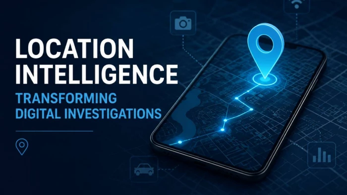
Digital investigations used to depend on what people remembered, what cameras captured, and what documents could prove. Today, location intelligence adds a harder layer of evidence: where a device moved, when it moved, what systems recorded that movement, and whether the timeline supports the claim being made.
That shift matters because phones, vehicles, apps, Wi-Fi networks, wearables, and connected platforms now create a continuous trail of location signals. The strongest investigations are no longer built around one map pin. They are built around verified movement patterns that connect time, place, behavior, and physical evidence.
Location intelligence has become central to modern disputes because movement data is now recorded across many everyday systems. Smartphones can connect to cell towers, GPS, Wi-Fi, Bluetooth, apps, and cloud services. Vehicles, workplaces, and businesses may also record routes, speed, badge access, security footage, delivery scans, timestamps, and network activity.
This gives investigators a clearer way to examine the facts. Instead of relying only on what people say, they can review what devices and systems recorded before, during, and after an event. This does not replace human judgment, but it helps reduce unsupported claims.
The impact is significant. A disputed route, denied visit, contested crash, attendance issue, or delivery failure can often be checked against location-linked records. When several independent systems show the same sequence, the evidence becomes much harder to dismiss.
Location intelligence is the process of collecting, comparing, and interpreting movement-related data from multiple systems. It is not the same as simply opening a map and looking at a GPS point. A single location record can be incomplete, delayed, inaccurate, or misunderstood.
A proper location intelligence review looks at the full context behind the data. It asks how the location was created, what device generated it, how precise it was, whether the timestamp is reliable, and whether another source confirms the same movement.
In digital investigations, the most useful records are usually not the most obvious ones. A photo with metadata, a parking app record, a toll transaction, a Wi-Fi connection, or a vehicle ignition log can sometimes matter more than a broad cell tower ping.
The value comes from sequence. A location point may show presence. A location timeline can show movement, delay, intent, contradiction, or opportunity.
A modern digital investigation may involve several location-linked records working together. Each record has a different role, and each must be interpreted according to its technical limits.
| Location Source | What It Can Show | Why It Matters |
| Cell-site records | A device connected to a tower within a general coverage area | Useful for broad timeline placement, but not exact positioning |
| GPS records | A device or vehicle followed a specific route | Strong when metadata, accuracy values, and timestamps are preserved |
| Wi-Fi connections | A device was near a known network or router | Helpful for indoor locations, offices, hotels, homes, and public venues |
| Bluetooth activity | A device was close to another device, vehicle, wearable, or beacon | Valuable for proving proximity, pairing, or in-vehicle presence |
| App location data | A platform recorded location during use or in the background | Useful when app permissions and data retention can be verified |
| Vehicle telematics | Route, speed, braking, steering, ignition, and crash-related behavior | Critical in crash, fleet, insurance, and delivery disputes |
| Camera and ALPR records | A person, vehicle, or license plate appeared at a location | Strong supporting evidence when timestamps are checked |
These sources become more powerful when reviewed together. A phone record may place a device in an area, but a parking record, camera timestamp, and vehicle log may show the route, stop time, and direction of travel. That combination is far stronger than any single source.
The biggest change is that investigations are becoming timeline-driven. A dot on a map may show where something happened, but a timeline helps explain how it happened by showing movement before, during, and after the event.
This matters because many disputes depend on timing. Access logs may challenge an arrival claim, vehicle data may contradict a driver’s statement, and GPS or scan records may show whether a delivery actually reached the right location.
| Issue in Dispute | Traditional Evidence | Location Intelligence Evidence |
| Presence at a location | Witness statements, photographs, manual records | Phone records, Wi-Fi connections, app logs, camera timestamps |
| Route taken | Memory, receipts, fuel stops, statements | GPS traces, toll records, vehicle telematics, navigation history |
| Time of arrival | Witness estimates, check-in notes, call records | Badge logs, parking apps, server timestamps, device activity |
| Crash sequence | Damage analysis, skid marks, driver statements | Speed logs, braking data, phone activity, connected vehicle records |
| Workplace attendance | Supervisor notes, timesheets, access cards | Badge scans, Wi-Fi logs, device connections, location-enabled apps |
The practical result is clear: many disputes are now less about competing stories and more about whether the digital timeline supports one version of events.
Location data can look precise, but it can be misleading when treated too casually. A GPS marker may drift. A cell tower may cover a wide area. A router location may be outdated. An app may collect location only during certain sessions. A vehicle record may require expert interpretation.
That is why investigators should avoid building a conclusion on one signal. Strong location intelligence depends on correlation.
Several checks matter in every serious review.
● The source of the location must be identified clearly: GPS, cell-site data, Wi-Fi positioning, Bluetooth proximity, app records, and vehicle telematics do not carry the same evidentiary weight. A report should explain how each location point was created before using it to support a conclusion.
● The timestamp must be normalized before comparison: Different systems may store time in local time, UTC, device time, server time, or platform-specific formats. If the time settings are not aligned, an otherwise accurate timeline can become misleading.
● The device must be linked to the person or vehicle: A phone location does not automatically prove the owner was holding it. A car record does not always prove who was driving. Investigators need supporting evidence such as unlock activity, app usage, Bluetooth pairing, access logs, or witness confirmation.
● The accuracy range must be explained: A record that places a device within a few meters is very different from one that places it somewhere inside a large tower coverage area. Precision should never be overstated.
● Conflicting records must be reviewed, not ignored: If one record supports a claim and another record contradicts it, the conflict must be explained. Good investigation work tests the full record, not only the convenient parts.
This is the difference between a map-based claim and a defensible digital investigation.
Location intelligence now plays an important role in many civil disputes, not only criminal investigations. Insurance claims, accident cases, employment conflicts, logistics disputes, construction disagreements, commercial litigation, and fraud reviews can all depend on movement evidence.
In workplace matters, location records may show building entry, network access, or client-site visits. In logistics disputes, GPS and scan records can identify where a delay occurred, while insurance reviews may use telematics to detect staged claims, exaggerated timelines, or inconsistent reports.
Accident disputes are especially affected because movement data can clarify what happened before impact. In complex injury claims, an Orlando car accident attorney may compare phone-location records, connected vehicle data, intersection footage, and crash-scene evidence to see whether the digital timeline matches the physical facts of the collision and helps test causation.
Location data is powerful because it reveals behavior, making it highly sensitive. A movement record can expose a person’s home, workplace, medical visits, religious activity, relationships, travel patterns, and daily routine—often revealing more than a direct conversation would.
Because of this, location-based investigations face growing scrutiny. The issue is not only whether the data is useful, but whether it was collected and used properly. Investigators must consider consent, legal authority, discovery rules, workplace policies, privacy notices, retention limits, and proportionality.
Geofence data is especially sensitive because it can identify devices within a specific area and time period, including people unrelated to the incident. Responsible location intelligence should be narrow, relevant, and explainable, focusing only on the records needed to answer the dispute.
Location evidence usually fails because it is overclaimed, poorly preserved, or presented without enough technical context. The data may be useful, but the interpretation may be weak.
The common problems are easy to identify.
● Screenshots replace original records: A screenshot may show a location point, but it often strips away metadata, accuracy values, timestamps, export details, and platform context. Original data exports or forensic collections are stronger.
● Investigators treat device location as human location: This is one of the most common errors. A phone, wearable, tablet, account, or vehicle may move without proving who controlled it at the relevant moment.
● Broad location data is presented as exact proof: Cell-site records and some app-based locations may show a general area, not a precise address. If that limitation is not explained, the evidence can appear stronger than it really is.
● Data retention is misunderstood: Many systems overwrite or delete useful records quickly. Security footage, app logs, vehicle data, and cloud records may disappear if preservation steps are delayed.
● Reports show conclusions before methodology: A location report should explain source, collection method, timestamp handling, accuracy limits, and correlation logic before making a conclusion. Otherwise, the analysis becomes vulnerable to challenge.
These failures are not minor technical mistakes. They can decide whether location evidence is trusted or rejected.
AI is making location investigations faster, especially when large datasets are involved. A single phone, vehicle fleet, or retail investigation may produce thousands of location-linked records from devices, apps, cameras, badges, payments, and network systems.
AI tools can help identify movement patterns, unusual stops, repeated routes, timeline gaps, and connections across multiple data sources. This makes early analysis more efficient and helps investigators find relevant events inside large records.
However, AI should not be treated as the final authority. Any flagged route, pattern, or device activity must still be verified against the source data. AI is useful for finding leads, but expert review is needed to explain and prove what those leads mean.
A location intelligence report should be clear enough for business leaders, lawyers, insurers, judges, or investigators to understand without needing to read raw data files. It should not overwhelm the reader with coordinates, but it should provide enough technical detail to support the conclusion.
A strong report usually includes a timeline, a source table, a map with relevant markers, a timestamp explanation, an accuracy review, and a comparison of supporting and conflicting records.
| Report Element | Why It Matters |
| Source inventory | Shows which systems were reviewed and what each source can prove |
| Timeline reconstruction | Places movement, activity, and events in the correct sequence |
| Accuracy explanation | Prevents broad or uncertain records from being overstated |
| Correlation analysis | Shows where independent records support the same conclusion |
| Conflict review | Identifies records that contradict or complicate the timeline |
| Clear conclusion | Separates confirmed facts from likely interpretations |
The best reports do not say more than the data supports. They separate confirmed findings from probable findings and leave room for uncertainty where the record is incomplete.
Businesses that use vehicles, delivery apps, mobile workforces, smart buildings, surveillance systems, employee devices, or field-service platforms should treat location data as an evidence asset and a privacy risk.
Waiting until a dispute happens is usually too late. By then, key records may already be deleted, overwritten, or locked inside a vendor platform.
A practical readiness plan should include the following steps.
● Build a location-data inventory: Companies should know which systems collect location records, including vehicles, mobile apps, access systems, cameras, Wi-Fi networks, delivery tools, field-service platforms, and third-party vendors.
● Set retention rules before disputes arise: Every system should have a known retention period. Businesses should understand which records last days, weeks, months, or years, and whether those timelines match legal and operational needs.
● Create a fast preservation process: When an incident, claim, accident, or investigation begins, the business should know who sends legal holds, who contacts vendors, and who secures device, vehicle, or platform records.
● Limit access to sensitive movement data: Location data should not be casually available across the organization. Access should be role-based, logged, and tied to a legitimate business or legal purpose.
● Explain tracking practices clearly: Employees, customers, and contractors should understand when tracking occurs, why the data is collected, and how it may be used in investigations or disputes.
This preparation helps businesses avoid two problems at once: losing valuable evidence and mishandling sensitive personal data.
Location intelligence will become more important as connected vehicles, smart devices, delivery platforms, workplace systems, wearables, drones, and IoT sensors create more movement records. Investigators will have more evidence to work with, but they will also face more privacy challenges and technical disputes.
The future of digital investigations will depend on disciplined interpretation. The strongest evidence will not be the largest dataset or the most detailed map. It will be the cleanest timeline, built from lawful collection, verified timestamps, reliable source data, and clear explanation.
Location intelligence is rewriting digital investigations because movement has become measurable. But a location point is not proof by itself. Proof comes from showing how that point fits into the full sequence of what happened.
Share your thoughts about this article.
Be the first to post a comment!
Most teams already have the video. What they do not have is a way to search it....
Mighva Verma1 day ago

IoT analytics starts with a simple problem: connected devices keep sending data,...
Vesper Barnes6 days ago
Every modern enterprise now operates two workforces. The first is the employees,...
Deepak Mehra1 month ago

Three months ago, I closed Cursor mid-sentence, downloaded a 180MB installer, an...
Sakshi Dhingra1 month ago

You've probably already read five articles trying to figure this out. I have too...
Sakshi Dhingra1 month ago
Locker manufacturing has come a long way from simple metal compartments used in...
Parveen Verma1 month ago