Location data tells stories that spreadsheets cannot. When businesses plot thousands of customer addresses on a map, patterns appear. Dense clusters show where demand concentrates. Empty spaces reveal untapped markets. Drive times between stops determine how many customers a sales rep can visit in one day. These spatial relationships shape business decisions, from where to open new locations to how to assign sales territories. Maptive turns raw location data into these visual insights, processing up to 100,000 locations simultaneously while maintaining 99.9% uptime according to Analytics Insight.
The platform runs entirely in web browsers, which means teams start creating maps within 30 minutes of signing up. No software installation, no coding knowledge, no technical expertise required. Users upload spreadsheets containing addresses, zip codes, or coordinates, and Maptive transforms those rows of data into interactive maps with heat maps, territories, and drive-time calculations. The location intelligence market where Maptive operates is valued at $25.06 billion in 2025 and forecast to reach $47.09 billion by 2030, expanding at a 13.45% CAGR according to market analysis firms.
Maptive builds on Google Maps platform technology while adding enterprise-level capabilities that Google's basic mapping tools lack. The platform processes more than 50,000 rows in under 30 seconds without causing browser lockups, according to iTech Post. While CARTO typically shows performance degradation above 30,000 to 50,000 points, Maptive maintains consistent speed even when handling maps with over 100,000 locations.
This processing power matters for real operations. Insurance companies process more than 250,000 geocodes every minute during claims surges. FedEx uses the platform to optimize delivery routes and manage service areas across thousands of locations. The WebGL map rendering introduced in recent updates allows more markers and boundaries to display simultaneously without performance issues, providing faster and smoother map interactions.
The heat map generator stands as one of Maptive's core features. Users visualize marker density or numerical data tied to geographic locations through color gradients that show concentration levels. A research student on Capterra reported taking thousands of cells of data and compiling them into maps showing electric vehicle distributions by zip code and Tesla Supercharging Stations with heat maps to create density maps.
Users customize these visualizations by adjusting radius, opacity, intensity threshold, and gradient colors. Sales teams use heat maps to identify where their customers cluster. Retail chains see which areas generate the most revenue. Healthcare organizations track disease outbreaks or patient populations. The visual patterns that emerge from raw data points guide resource allocation and expansion planning.
Sales territory imbalances cost companies money. When one rep covers twice as many accounts as another, or when territories ignore natural boundaries like rivers or highways, inefficiencies multiply. Maptive's territory analysis tools use actual data to create fair divisions. The software examines factors like customer count, revenue potential, and drive times when suggesting territory boundaries.
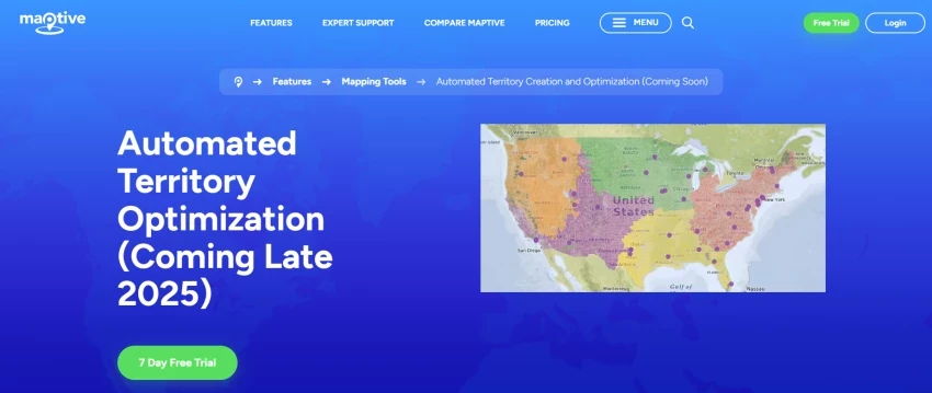
The boundary tool lets users build territories or draw custom territories based on business needs. Coming late 2025, Maptive's automated territory management algorithm will generate accurate territory maps based on data, taking the guesswork out of splitting up territories with AI assistance. The automatic tools already simplify making or updating large territories. An entire realignment that once took a full workday now takes a few minutes.
Distance measurements on maps tell only part of the story. A customer 10 miles away on a highway takes less time to reach than one 5 miles away through city traffic. Drive-time polygons let users see which locations are reachable in a given amount of time. Sales managers use this feature to assign customers to sales reps based on actual driving times rather than straight-line distances.
Maptive iQ, the platform's enhanced version, uses 300% more calculation points than earlier software for drive-time calculations. Users can plan drive times up to 4 hours with better accuracy, with an 8-hour window becoming possible by late 2025 according to TechHQ. Field service companies report these improvements deliver measurable results. Tests by logistics teams show routing errors drop by about 22%, while fuel costs in pilot studies fell as much as 15%.
The route optimization feature generates optimized routes in seconds. Users enter their starting location and an unlimited number of stops, and the platform creates the quickest route between all locations. The software factors in real-time traffic data from Google Maps, adjusting routes based on current conditions rather than theoretical distances.
A logistics firm processed thousands of routes in seconds, which reduced holiday shipping delays by over 40% according to industry publications. A field service company saw an 18% drop in fuel costs and a 22% increase in completed service calls after adopting Maptive iQ. Sales teams plan their days more efficiently, with field reps able to see all their appointments on a map and calculate the best route between them.
Maptive pulls population data from the U.S. Census to bolster maps. Users see population density, age, median household income, race, and education levels without uploading anything extra. This demographic capability supports market analysis and expansion planning by revealing the characteristics of areas where businesses operate or plan to expand.
Demographic overlays in Maptive iQ access new data streams including mobile signals and purchasing trends. The demographic layer can pinpoint underserved areas with up to 90% precision based on source data, according to Inbound Logistics. Reviews note high satisfaction with demographic tools and map overlays, with 89% pointing to easier territory assessment when combined with heat map use.
The platform connects CRM systems to Maptive iQ in real time. Salesforce users sync data automatically without manual uploads. As records update in the CRM system, Maptive iQ maps update at the same time. Beta users with Salesforce report that map and data updates synchronize with a lag of under 90 seconds.
This integration allows sales teams and managers to see current customer assignments and sales performance by region. Regional managers use these tools to see how their entire team covers a territory and identify gaps in coverage. The improved CRM integration framework launched with Maptive iQ continues expanding to include more platforms.
All data is secured using 256-bit SSL encryption, addressing security concerns for businesses handling sensitive location information. The platform was built from the ground up with security considerations, featuring powerful encryption, fully redundant backup and recovery systems, two-factor authentication, full permission level control, password requirements, and Cloudflare endpoint protection.
These security measures matter for enterprises mapping customer locations, delivery routes, or sensitive operational data. The combination of encryption, access controls, and backup systems ensures that location intelligence remains both accessible to authorized users and protected from unauthorized access.
Maptive offers live phone, email, and chat support to both paying and free users. A sales operations professional on G2 explained that when they had questions, live chat gave direct answers that solved issues on the first try. The company takes customer support seriously and maintains some of the highest levels of customer satisfaction in the industry according to Capterra reviews.
Users consistently mention the quick and responsive customer support as enhancing their experience with the software. Staff members can import CSVs, build heat maps, set territories, and run drive-time analyses without hand-holding, but when questions arise, support provides immediate assistance.
Current pricing includes a 45-day pass at $250 for teams testing the platform. The Team plan costs $2,500 per year and includes support for up to 400,000 geocoded addresses. At the highest tier, Enterprise clients can process over 1 million geocodes monthly and build up to 500 private maps.
This tiered structure allows businesses to start small and expand their usage as needs grow. The pricing reflects the platform's positioning in a location intelligence market experiencing 13.45% annual growth, with businesses recognizing the value of spatial analytics for competitive advantage.
Maptive earned the number 1 ranking in Best Online Mapping Software according to January 2025 industry reviews. Multiple business technology publications named it Most User-Friendly Location Intelligence Platform in mid-2025. The platform's Maptive iQ feature made the shortlist for Innovation in Business Mapping awards.
Independent technology reviews from August 2025 position Maptive as a leader in business mapping software, particularly noting its heat mapping, territory analysis, and real-time data visualization tools. Performance measurements show the platform operates 3 to 5 times faster than ArcGIS and Mapline when loading complex layers or large CSV files, according to Tech Buzz Ireland.
Supply chain departments map their entire logistics network on the platform. They plot warehouse locations, distribution centers, and delivery destinations on a single map. Drive time analytics show how long shipments take between points and help identify bottlenecks in the distribution network.
Healthcare organizations track patient populations and service areas. Real estate companies analyze market conditions and property values. Nonprofit organizations visualize donor locations and plan fundraising events. Retail operations identify optimal store locations based on demographic data and competitor positions. Each sector benefits from the visual intelligence and spatial analysis capabilities the platform provides for strategic planning and operational efficiency.
Location intelligence transforms how businesses understand their markets, customers, and operations. Maptive provides the tools to turn location data into actionable insights without requiring technical expertise or lengthy implementation periods. The platform processes vast amounts of data while maintaining speed and reliability that enterprises require.
As the location intelligence market grows from $25.06 billion to a projected $47.09 billion by 2030, businesses that harness spatial analytics gain competitive advantages. Maptive's combination of processing power, ease of use, and comprehensive features positions users to capture these advantages. From heat maps that reveal customer concentrations to drive-time calculations that optimize routes, the platform turns geographic data into business intelligence that drives decisions and improves operations.
Be the first to post comment!

The first time I realized something was wrong with my content was late at night...
Sakshi Dhingra1 day ago

Vheer AI is interesting not just because of what it does, but because of what it...
Parveen Verma1 day ago

Why I looked into Leeco AI in the first placeOver the past few years, I have not...
Sakshi Dhingra3 days ago

When I first came across Skipit, I approached it with a bit of skepticism. The A...
Sakshi Dhingra5 days ago

I didn’t start exploring Dzine AI because I was chasing the latest AI trend. I d...
Sakshi Dhingra6 days ago

The positioning of Promptchan within the AI ecosystem is often misunderstood. Wh...
Sakshi Dhingra2 weeks ago